GEO Satellites: Understanding the Technology and Applications of Geostationary Orbit Satellites
GEO Satellites: Understanding the Technology and Applications of Geostationary Orbit Satellites
GEO satellites, or geostationary orbit satellites, are a type of satellite that orbits the Earth at an altitude of approximately 36,000 kilometers, remaining stationary relative to a fixed point on the Earth’s surface. This unique characteristic allows GEO satellites to provide continuous coverage of a specific region, making them ideal for a wide range of applications, including telecommunications, navigation, and weather forecasting. In this article, we will delve into the technology and applications of GEO satellites, exploring their history, design, and uses.
History of GEO Satellites
The concept of GEO satellites was first proposed by science fiction writer Arthur C. Clarke in 1945. However, it wasn’t until the 1960s that the first GEO satellite, Syncom 2, was launched. Since then, the technology has evolved significantly, with advancements in materials, propulsion systems, and electronics. Today, there are over 500 GEO satellites in orbit, providing a wide range of services, including television broadcasting, telecommunications, and navigation.
Design and Technology of GEO Satellites
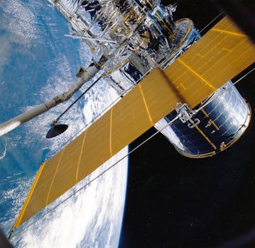
GEO satellites are designed to operate in the harsh environment of space, with extreme temperatures, radiation, and lack of atmosphere. They are typically equipped with solar panels, batteries, and propulsion systems, which enable them to maintain their position and operate for extended periods. The satellite’s payload, which includes the communication equipment, navigation system, and other instruments, is designed to provide specific services, such as television broadcasting, internet connectivity, or weather forecasting. The satellite’s antenna system is also critical, as it enables the transmission and reception of signals to and from the Earth.
Applications of GEO Satellites
GEO satellites have a wide range of applications, including telecommunications, navigation, weather forecasting, and Earth observation. They provide television broadcasting services, internet connectivity, and mobile communications, connecting remote and underserved communities. GEO satellites also enable navigation systems, such as GPS, which provide location information and timing signals. Weather forecasting is another critical application, as GEO satellites monitor cloud patterns, atmospheric conditions, and ocean currents, enabling accurate predictions and warnings. Finally, GEO satellites are used for Earth observation, providing valuable data on climate change, natural disasters, and environmental monitoring.
Future of GEO Satellites
The future of GEO satellites is promising, with advancements in technology and new applications emerging. The development of high-throughput satellites, which offer faster data rates and higher capacity, is expected to transform the telecommunications industry. The use of GEO satellites for navigation and weather forecasting is also expected to continue, with the development of new systems and instruments. Furthermore, the growing demand for Earth observation data is driving the development of new satellite constellations, which will provide high-resolution images and data on the environment and climate change.


