GEO Satellites: Understanding the Technology and Applications of Geostationary Orbit Satellites
GEO Satellites: Introduction to Geostationary Orbit Satellites
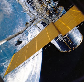
GEO satellites, or geostationary orbit satellites, are a type of satellite that orbits the Earth at an altitude of approximately 36,000 kilometers, which is about 22,300 miles. At this altitude, the satellite’s orbital period matches the Earth’s rotational period, allowing it to remain stationary above a fixed point on the equator. This unique characteristic makes GEO satellites ideal for a wide range of applications, including telecommunications, navigation, and weather forecasting.
How GEO Satellites Work
GEO satellites work by using a combination of propulsion systems and gravitational forces to maintain their position in geostationary orbit. Once in orbit, the satellite uses its propulsion system to make fine adjustments to its position and velocity, ensuring that it remains stationary above its designated point on the equator. The satellite’s payload, which can include transponders, antennas, and other equipment, is then used to transmit and receive signals to and from Earth.
Applications of GEO Satellites
GEO satellites have a wide range of applications, including telecommunications, navigation, and weather forecasting. In telecommunications, GEO satellites are used to provide broadband internet access, telephony, and television broadcasting to remote and underserved areas. They are also used to support mobile networks, providing connectivity to areas where terrestrial infrastructure is limited or non-existent. In navigation, GEO satellites are used to provide location information and timing signals, which are used in a wide range of applications, including aviation, maritime, and land transportation. Finally, in weather forecasting, GEO satellites are used to provide high-resolution images of the Earth’s atmosphere, which are used to predict weather patterns and track severe weather events.
Benefits and Challenges of GEO Satellites
The use of GEO satellites offers a number of benefits, including global coverage, high bandwidth, and reliability. However, there are also challenges associated with the use of GEO satellites, including the high cost of launch and operation, the risk of satellite failure, and the potential for interference from other satellites and terrestrial systems. Additionally, the increasing number of satellites in geostationary orbit has raised concerns about the risk of collisions and the potential for debris to accumulate in orbit.
Future of GEO Satellites
Despite the challenges associated with the use of GEO satellites, they are likely to continue to play a crucial role in modern telecommunications, navigation, and weather forecasting. The development of new technologies, such as high-throughput satellites and advanced propulsion systems, is expected to improve the performance and efficiency of GEO satellites, while reducing their cost and environmental impact. Additionally, the increasing demand for satellite-based services, particularly in remote and underserved areas, is expected to drive the growth of the GEO satellite market in the coming years.


