GEO Satellites: Understanding the Technology and Applications of Geostationary Orbit Satellites
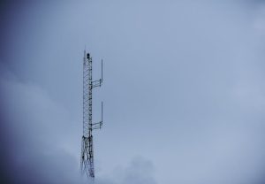
GEO satellites, or geostationary orbit satellites, are a type of satellite that orbits the Earth at an altitude of approximately 36,000 kilometers. These satellites are designed to remain stationary relative to a fixed point on the Earth’s surface, allowing them to provide continuous coverage of a specific region. In this article, we will explore the technology and applications of GEO satellites, and how they have become an essential part of modern telecommunications, navigation, and weather forecasting.
GEO satellites are placed in a geostationary orbit, which is a circular orbit that allows the satellite to maintain a fixed position relative to the Earth’s surface. This is achieved by matching the satellite’s orbital period to the Earth’s rotational period, which is approximately 24 hours. As a result, the satellite appears to be stationary in the sky, allowing it to provide continuous coverage of a specific region.
History of GEO Satellites
The concept of GEO satellites was first proposed by scientist Arthur C. Clarke in 1945. However, it wasn’t until the 1960s that the first GEO satellite, Syncom 2, was launched. Syncom 2 was a experimental satellite that demonstrated the feasibility of geostationary orbit and paved the way for the development of modern GEO satellites.
Today, there are hundreds of GEO satellites in orbit, providing a wide range of services including telecommunications, navigation, weather forecasting, and Earth observation. These satellites have become an essential part of modern life, enabling global communication, navigation, and weather forecasting.
Applications of GEO Satellites
GEO satellites have a wide range of applications, including:
Telecommunications: GEO satellites are used to provide telecommunications services such as television broadcasting, telephone connections, and internet access. They are particularly useful for providing services to remote or underserved areas where traditional telecommunications infrastructure is lacking.
Navigation: GEO satellites are used to provide navigation services such as GPS, which is used for a wide range of applications including aviation, maritime, and land transportation.
Weather Forecasting: GEO satellites are used to provide weather forecasting services, including monitoring weather patterns, tracking storms, and predicting weather conditions.
Earth Observation: GEO satellites are used to provide Earth observation services, including monitoring environmental changes, tracking natural disasters, and providing data for climate modeling.
Challenges and Limitations of GEO Satellites
Despite the many benefits of GEO satellites, there are also several challenges and limitations to their use. These include:
Orbital Congestion: The geostationary orbit is a limited resource, and the increasing number of satellites in orbit is leading to concerns about orbital congestion and the potential for collisions.
Interference: GEO satellites can be affected by interference from other satellites and terrestrial sources, which can impact their performance and reliability.
Atmospheric Drag: GEO satellites are affected by atmospheric drag, which can cause them to lose altitude and eventually fall out of orbit.
Space Debris: GEO satellites can contribute to the problem of space debris, which is a growing concern for the satellite industry.
Future of GEO Satellites
Despite the challenges and limitations of GEO satellites, they are likely to remain an essential part of modern telecommunications, navigation, and weather forecasting for the foreseeable future. Advances in technology are continually improving the performance and capabilities of GEO satellites, and new applications are being developed all the time.
In conclusion, GEO satellites are a crucial part of modern telecommunications, navigation, and weather forecasting. Their ability to provide continuous coverage of a specific region makes them an essential tool for a wide range of applications. While there are challenges and limitations to their use, advances in technology are continually improving their performance and capabilities, and new applications are being developed all the time.