GEO Satellites: Understanding the Technology and Applications of Geostationary Orbit Satellites
GEO Satellites: Introduction to Geostationary Orbit Satellites
GEO satellites, or geostationary orbit satellites, are a type of satellite that orbits the Earth at an altitude of approximately 36,000 kilometers, remaining stationary relative to a fixed point on the equator. This unique characteristic allows GEO satellites to provide continuous coverage of a specific region, making them ideal for various applications such as telecommunications, navigation, and weather forecasting. The focus of this article is on GEO satellites, and we will explore their technology and applications in depth.
The concept of GEO satellites was first proposed by science fiction writer Arthur C. Clarke in 1945, and the first GEO satellite, Syncom 2, was launched in 1963. Since then, hundreds of GEO satellites have been launched, with many more planned for the future. GEO satellites have revolutionized the way we communicate, navigate, and predict the weather, and their impact will only continue to grow as technology advances.
Design and Technology of GEO Satellites
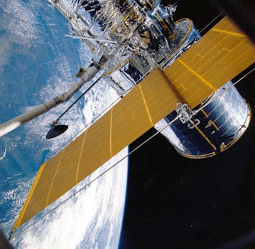
GEO satellites are designed to operate in the harsh environment of space, with extreme temperatures, radiation, and vacuum conditions. They are typically equipped with solar panels to generate power, as well as propulsion systems to maintain their orbit and attitude. The payload of a GEO satellite depends on its specific application, but common components include transponders, antennas, and sensors.
One of the key challenges in designing GEO satellites is ensuring their stability and longevity. GEO satellites must be able to maintain their orbit and pointing accuracy for extended periods, often up to 15 years or more. This requires precise control systems, as well as robust materials and construction to withstand the stresses of launch and operation in space.
Applications of GEO Satellites
GEO satellites have a wide range of applications, including telecommunications, navigation, weather forecasting, and Earth observation. In telecommunications, GEO satellites provide broadband connectivity, television broadcasting, and mobile communications. Navigation systems such as GPS rely on GEO satellites to provide location and timing information. Weather forecasting uses GEO satellites to monitor cloud patterns, atmospheric conditions, and ocean currents.
Earth observation is another critical application of GEO satellites, with uses ranging from environmental monitoring to disaster response. GEO satellites can provide high-resolution imagery of the Earth’s surface, allowing scientists to track changes in land use, deforestation, and ocean health. This information is essential for understanding and mitigating the impacts of climate change, as well as responding to natural disasters such as hurricanes and wildfires.
Impact and Future of GEO Satellites
The impact of GEO satellites on modern society is undeniable. They have enabled global communications, facilitated international trade and commerce, and improved our understanding of the Earth’s climate and environment. As technology continues to advance, we can expect to see even more innovative applications of GEO satellites, from advanced navigation systems to enhanced Earth observation capabilities.
However, the growing number of satellites in orbit also poses challenges, such as increased risk of collisions and space debris. The development of new technologies, such as satellite servicing and debris removal, will be essential to ensuring the long-term sustainability of the GEO satellite constellation. Additionally, the increasing demand for satellite bandwidth and services will require the development of more efficient and cost-effective launch systems, as well as improved satellite design and operations.


