GEO Satellites: Understanding the Technology and Applications of Geostationary Orbit Satellites
GEO satellites, or geostationary orbit satellites, are a type of satellite that orbits the Earth at an altitude of approximately 36,000 kilometers, remaining stationary relative to a fixed point on the equator. This unique orbit allows GEO satellites to provide continuous coverage of a specific region, making them ideal for a variety of applications, including telecommunications, navigation, and weather forecasting.
GEO satellites, or geostationary orbit satellites, are a type of satellite that orbits the Earth at an altitude of approximately 36,000 kilometers, remaining stationary relative to a fixed point on the equator. This unique orbit allows GEO satellites to provide continuous coverage of a specific region, making them ideal for a variety of applications, including telecommunications, navigation, and weather forecasting.
The concept of GEO satellites was first proposed by science fiction author Arthur C. Clarke in 1945, and the first GEO satellite, Syncom 2, was launched in 1963. Since then, numerous GEO satellites have been launched, and they have become a crucial part of modern telecommunications and navigation systems. One of the primary advantages of GEO satellites is their ability to provide continuous coverage of a specific region, making them ideal for applications such as telecommunications, where a stable and reliable connection is essential.
GEO satellites are used in a variety of applications, including telecommunications, navigation, weather forecasting, and Earth observation. In telecommunications, GEO satellites are used to provide internet connectivity, voice communications, and television broadcasting. They are also used in navigation systems, such as GPS, to provide location information and timing signals. In weather forecasting, GEO satellites are used to monitor cloud patterns, track storms, and predict weather patterns. Additionally, GEO satellites are used in Earth observation applications, such as monitoring deforestation, tracking ocean currents, and detecting natural disasters.
How GEO Satellites Work
GEO satellites work by orbiting the Earth at an altitude of approximately 36,000 kilometers, which is the exact distance required for a satellite to remain stationary relative to a fixed point on the equator. This orbit is known as a geostationary orbit, and it allows the satellite to maintain a constant position in the sky, relative to a fixed point on the Earth’s surface. The satellite’s orbit is synchronized with the Earth’s rotation, which means that it completes one orbit around the Earth in exactly 24 hours, the same amount of time it takes the Earth to rotate once on its axis.
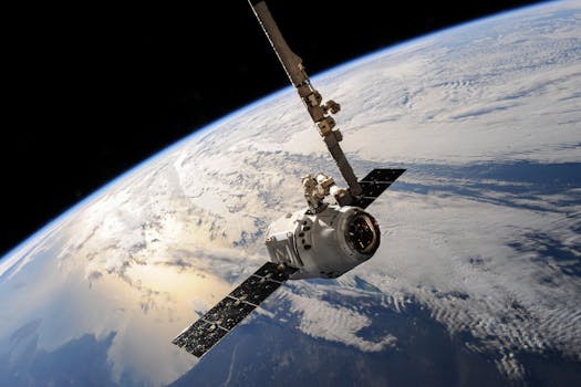
GEO satellites are typically equipped with a variety of instruments, including transponders, antennas, and solar panels. The transponders are used to receive and transmit signals, while the antennas are used to communicate with Earth stations and other satellites. The solar panels are used to generate power, which is stored in batteries and used to power the satellite’s systems. GEO satellites are also equipped with propulsion systems, which are used to maintain the satellite’s orbit and make any necessary adjustments.
Applications of GEO Satellites
GEO satellites have a wide range of applications, including telecommunications, navigation, weather forecasting, and Earth observation. In telecommunications, GEO satellites are used to provide internet connectivity, voice communications, and television broadcasting. They are also used in navigation systems, such as GPS, to provide location information and timing signals. In weather forecasting, GEO satellites are used to monitor cloud patterns, track storms, and predict weather patterns. Additionally, GEO satellites are used in Earth observation applications, such as monitoring deforestation, tracking ocean currents, and detecting natural disasters.
In addition to these applications, GEO satellites are also used in a variety of other fields, including astronomy, space exploration, and national security. They are used to study the Earth’s climate, monitor the Earth’s magnetic field, and track the movement of celestial objects. They are also used in space exploration, to provide communication and navigation services for spacecraft, and to study the effects of space weather on satellite systems.
Advantages and Disadvantages of GEO Satellites
GEO satellites have several advantages, including their ability to provide continuous coverage of a specific region, their high altitude, which allows them to communicate with a large number of Earth stations, and their long lifespan, which can range from 10 to 20 years. They are also relatively low maintenance, as they do not require frequent orbit adjustments or propulsion system maintenance. However, GEO satellites also have several disadvantages, including their high cost, which can range from $100 million to $1 billion, their limited bandwidth, which can limit the amount of data that can be transmitted, and their vulnerability to space debris and other forms of interference.
Despite these disadvantages, GEO satellites remain a crucial part of modern telecommunications and navigation systems. They are used in a variety of applications, including telecommunications, navigation, weather forecasting, and Earth observation, and they have several advantages, including their ability to provide continuous coverage of a specific region and their long lifespan. As technology continues to evolve, it is likely that GEO satellites will play an even more important role in the future of space exploration and development.
Conclusion
In conclusion, GEO satellites are a type of satellite that orbits the Earth at an altitude of approximately 36,000 kilometers, remaining stationary relative to a fixed point on the equator. They have a wide range of applications, including telecommunications, navigation, weather forecasting, and Earth observation, and they have several advantages, including their ability to provide continuous coverage of a specific region and their long lifespan. While they also have several disadvantages, including their high cost and limited bandwidth, they remain a crucial part of modern telecommunications and navigation systems. As technology continues to evolve, it is likely that GEO satellites will play an even more important role in the future of space exploration and development.


