GEO satellites, or geostationary satellites, are a type of satellite that orbits the Earth at an altitude of approximately 36,000 kilometers, remaining stationary relative to a fixed point on the Earth’s surface. GEO satellites have been a cornerstone of modern telecommunications, providing a wide range of services including television broadcasting, telecommunications, and Earth observation.
The concept of GEO satellites was first proposed by scientist Arthur C. Clarke in 1945, and the first geostationary satellite, Syncom 2, was launched in 1963. Since then, the technology has evolved significantly, with modern GEO satellites featuring advanced propulsion systems, high-gain antennas, and sophisticated payload technologies.
How GEO Satellites Work
GEO satellites work by using a combination of gravitational and centrifugal forces to maintain a stationary orbit around the Earth. The satellite’s altitude and velocity are carefully calibrated to ensure that it remains above a fixed point on the Earth’s surface, typically at the equator. This allows the satellite to maintain continuous communication with a specific region of the Earth, making it ideal for applications such as telecommunications and television broadcasting.
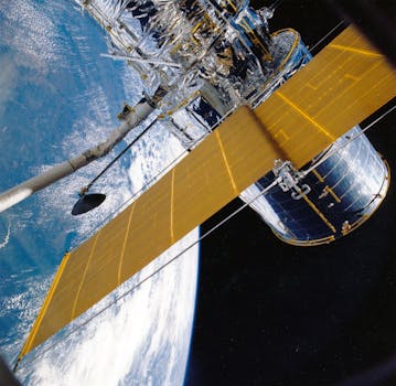
The payload of a GEO satellite typically consists of a range of instruments and antennas designed to support specific applications. For example, a telecommunications satellite may feature a high-gain antenna and a transponder to amplify and re-transmit signals, while an Earth observation satellite may feature a range of sensors and cameras to collect data on the environment.
Applications of GEO Satellites
GEO satellites have a wide range of applications, including telecommunications, television broadcasting, Earth observation, and navigation. In the field of telecommunications, GEO satellites are used to provide internet connectivity, voice communications, and data transmission services to remote or underserved areas. They are also used to support disaster response and recovery efforts, providing critical communication services in the aftermath of a disaster.
In the field of Earth observation, GEO satellites are used to collect data on the environment, including weather patterns, ocean currents, and land use. They are also used to monitor climate change, track natural disasters, and support agricultural management. The data collected by GEO satellites is used to support a wide range of applications, from weather forecasting to environmental monitoring.
Challenges and Future Developments
Despite the many benefits of GEO satellites, there are also several challenges associated with their use. One of the main challenges is the risk of satellite interference, which can occur when two or more satellites operating in the same frequency band interfere with each other. This can result in a loss of signal quality and potentially even complete signal loss.
Another challenge facing the GEO satellite industry is the growing problem of space debris. As the number of satellites in orbit increases, so does the risk of collisions and the accumulation of debris. This can pose a significant threat to the long-term sustainability of space-based services, and efforts are being made to develop new technologies and strategies to mitigate the problem.
Conclusion
In conclusion, GEO satellites play a vital role in modern telecommunications and Earth observation. Their ability to provide continuous communication and data collection services makes them an essential tool for a wide range of applications. As the technology continues to evolve, we can expect to see even more innovative uses of GEO satellites in the future, from advanced telecommunications services to new Earth observation capabilities.