GEO Satellites: Understanding the Technology and Its Applications
GEO satellites, or Geostationary Orbit satellites, are a type of satellite that orbits the Earth at an altitude of approximately 36,000 kilometers. At this height, the satellite’s orbital period matches the Earth’s rotational period, allowing it to remain stationary in the sky. This unique characteristic makes GEO satellites ideal for communication, navigation, and weather forecasting applications.
The concept of GEO satellites was first proposed by science fiction writer Arthur C. Clarke in 1945. Since then, the technology has evolved significantly, with the first GEO satellite, Syncom 2, launched in 1963. Today, there are hundreds of GEO satellites in orbit, providing a wide range of services, including television broadcasting, telecommunications, and weather forecasting.
How GEO Satellites Work
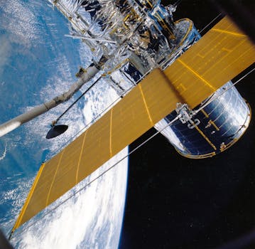
GEO satellites use a combination of solar panels and batteries to generate power. The solar panels convert sunlight into electrical energy, which is then stored in batteries for use during periods of darkness. The satellite’s communication equipment, including transponders and antennas, are powered by this energy.
The satellite’s communication system works by receiving signals from Earth stations, amplifying them, and then re-transmitting them back to Earth. This process is called transponding. The satellite’s transponders are designed to operate at specific frequency bands, such as C-band, Ku-band, or Ka-band, which are allocated for different applications.
Applications of GEO Satellites
GEO satellites have a wide range of applications, including:
Television broadcasting: GEO satellites are used to broadcast television channels to a wide audience. They can transmit signals to entire continents, making them ideal for global broadcasting.
Telecommunications: GEO satellites provide international communication services, including voice, data, and internet connectivity. They are particularly useful for remote or underserved areas where terrestrial infrastructure is lacking.
Weather forecasting: GEO satellites are used to monitor weather patterns and provide forecasting services. They can detect changes in cloud patterns, sea surface temperatures, and other environmental factors that affect the weather.
Challenges and Limitations of GEO Satellites
Despite their many advantages, GEO satellites also face several challenges and limitations. One of the main challenges is the high cost of launching and maintaining a GEO satellite. The launch process is complex and expensive, and the satellite must be designed to withstand the harsh conditions of space.
Another limitation of GEO satellites is the risk of interference from other satellites or terrestrial sources. This can cause signal degradation or loss, which can impact the quality of services provided by the satellite.
Finally, GEO satellites are also subject to the effects of space weather, such as solar flares and coronal mass ejections. These events can cause damage to the satellite’s electronics and disrupt its operations.


