GEO Satellites: Understanding the Technology and Its Applications
GEO satellites, or Geostationary Earth Orbit satellites, are a type of satellite that orbits the Earth at an altitude of approximately 36,000 kilometers, which is about 22,300 miles. At this distance, the satellite’s orbital period matches the Earth’s rotational period, allowing it to remain stationary relative to a fixed point on the Earth’s surface. This unique characteristic makes GEO satellites ideal for a variety of applications, including telecommunications, television broadcasting, and weather forecasting.
GEO satellites have been in use for several decades, with the first GEO satellite, Syncom 2, launched in 1963. Since then, numerous GEO satellites have been launched, providing a wide range of services to people around the world. One of the primary advantages of GEO satellites is their ability to provide continuous coverage of a specific region, making them ideal for applications such as television broadcasting and telecommunications.
How GEO Satellites Work
GEO satellites work by transmitting and receiving signals to and from Earth-based stations. The satellite receives signals from a ground station, amplifies them, and then re-transmits them back to Earth, where they can be received by other ground stations or directly by consumers. This process allows GEO satellites to provide a wide range of services, including television broadcasting, telecommunications, and data transmission.
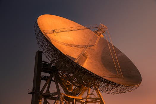
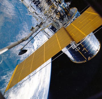
GEO satellites are typically equipped with a range of instruments, including transponders, antennas, and solar panels. Transponders are used to amplify and re-transmit signals, while antennas are used to receive and transmit signals. Solar panels are used to provide power to the satellite, allowing it to operate continuously.
Applications of GEO Satellites
GEO satellites have a wide range of applications, including telecommunications, television broadcasting, and weather forecasting. In the field of telecommunications, GEO satellites are used to provide telephone and internet services to remote and underserved areas. They are also used to provide backup services in the event of a disaster or outage.
In the field of television broadcasting, GEO satellites are used to transmit signals to cable and satellite television providers, allowing them to broadcast a wide range of channels to consumers. They are also used to provide direct-to-home (DTH) television services, allowing consumers to receive signals directly from the satellite.
In the field of weather forecasting, GEO satellites are used to provide images of the Earth’s weather patterns, allowing meteorologists to track storms and predict weather patterns. They are also used to provide data on the Earth’s climate, allowing scientists to study the effects of climate change.
Challenges and Limitations of GEO Satellites
While GEO satellites have a wide range of applications, they also have several challenges and limitations. One of the primary challenges is the high cost of launching and operating a GEO satellite. The cost of launching a GEO satellite can be tens of millions of dollars, and the cost of operating it can be hundreds of thousands of dollars per year.
Another challenge is the risk of satellite failure, which can occur due to a range of factors, including technical malfunctions and space debris. When a GEO satellite fails, it can have significant consequences, including the loss of critical services and the risk of collisions with other satellites.
Finally, GEO satellites are also subject to regulatory challenges, including the need to obtain licenses and permits from regulatory agencies. This can be a time-consuming and complex process, requiring significant resources and expertise.
Conclusion
In conclusion, GEO satellites play a crucial role in modern telecommunications, providing a wide range of services including television broadcasting, telecommunications, and weather forecasting. While they have several challenges and limitations, they remain a vital part of the global telecommunications infrastructure. As the demand for telecommunications services continues to grow, it is likely that GEO satellites will remain an important part of the mix, providing critical services to people around the world.
See more: