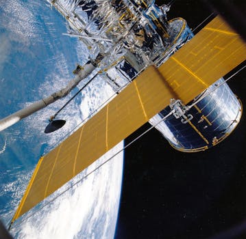
GEO Satellites: Understanding the Technology and Its Applications
GEO satellites, or Geostationary Earth Orbit satellites, are a type of satellite that orbits the Earth at an altitude of approximately 36,000 kilometers. They are designed to remain stationary in relation to a specific point on the Earth’s surface, providing continuous coverage of a particular region. GEO satellites play a crucial role in modern telecommunications, providing global coverage and enabling a wide range of applications, including telecommunications, broadcasting, weather forecasting, and navigational services.
The technology behind GEO satellites is complex and fascinating. These satellites are equipped with sophisticated transponders that receive and retransmit signals, allowing them to communicate with Earth stations and other satellites. They are also equipped with advanced propulsion systems, which enable them to maintain their position and altitude in orbit. The orbital period of a GEO satellite is approximately 24 hours, which is the same as the Earth’s rotational period. This allows the satellite to remain stationary in relation to a specific point on the Earth’s surface.
The Benefits of GEO Satellites
GEO satellites offer a number of benefits, including global coverage, high bandwidth, and reliability. They are ideal for applications that require continuous coverage of a particular region, such as telecommunications and broadcasting. They are also used for weather forecasting and navigational services, providing critical data and information to users around the world. Additionally, GEO satellites are relatively low maintenance, as they do not require frequent adjustments to their orbit or position.
One of the primary benefits of GEO satellites is their ability to provide global coverage. They can communicate with Earth stations and other satellites, allowing them to transmit data and signals to any point on the globe. This makes them ideal for applications such as telecommunications and broadcasting, where global coverage is essential. They are also used for weather forecasting and navigational services, providing critical data and information to users around the world.
Applications of GEO Satellites
GEO satellites have a wide range of applications, including telecommunications, broadcasting, weather forecasting, and navigational services. They are used by governments, corporations, and individuals around the world, providing critical data and information to users. They are also used for disaster response and recovery efforts, providing communication services and critical data to affected areas.
In addition to their practical applications, GEO satellites also have a number of scientific and research uses. They are used to study the Earth’s atmosphere, oceans, and land surfaces, providing critical data and information to scientists and researchers. They are also used to study the Sun and the solar system, providing insights into the formation and evolution of our universe.
Conclusion
In conclusion, GEO satellites play a crucial role in modern telecommunications, providing global coverage and enabling a wide range of applications. Their technology is complex and fascinating, and their benefits are numerous. They are ideal for applications that require continuous coverage of a particular region, such as telecommunications and broadcasting. They are also used for weather forecasting and navigational services, providing critical data and information to users around the world.
As technology continues to evolve, it is likely that GEO satellites will play an increasingly important role in our daily lives. They will continue to provide global coverage and enable a wide range of applications, from telecommunications and broadcasting to weather forecasting and navigational services. Whether you are a scientist, researcher, or simply someone who uses a cell phone or watches TV, GEO satellites are an essential part of our modern world.
