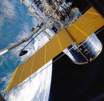
GEO Satellites: Unlocking the Power of Geostationary Orbit

GEO Satellites: Unlocking the Power of Geostationary Orbit
GEO satellites, or geostationary satellites, are a type of satellite that orbits the Earth at an altitude of approximately 36,000 kilometers, remaining stationary above a fixed point on the equator. This unique orbit allows GEO satellites to maintain a constant view of a specific region, making them ideal for a variety of applications, including telecommunications, weather forecasting, and navigation.
GEO satellites have been in use for decades, with the first geostationary satellite, Syncom 2, launched in 1963. Since then, the technology has continued to evolve, with advancements in satellite design, launch vehicles, and ground equipment. Today, GEO satellites play a vital role in modern satellite communications, providing a wide range of services, including television broadcasting, internet connectivity, and mobile communications.
How GEO Satellites Work
GEO satellites work by transmitting and receiving signals to and from Earth-based stations. The satellite acts as a repeater, amplifying the signal and re-transmitting it back to Earth. This allows for communication between two points on the planet, even if they are separated by vast distances. The geostationary orbit of the satellite ensures that the signal is always available, providing a constant and reliable connection.
The process of communicating through a GEO satellite involves several steps. First, a signal is transmitted from an Earth-based station to the satellite. The satellite then receives the signal, amplifies it, and re-transmits it back to Earth. The signal is then received by another Earth-based station, which decodes the signal and extracts the original information.
Applications of GEO Satellites
GEO satellites have a wide range of applications, including telecommunications, weather forecasting, and navigation. In the field of telecommunications, GEO satellites are used for television broadcasting, internet connectivity, and mobile communications. They provide a means of communicating with remote or underserved areas, where traditional communication infrastructure may not be available.
In addition to telecommunications, GEO satellites are also used for weather forecasting and navigation. They provide images of the Earth’s surface and atmosphere, which are used to forecast weather patterns and track storms. They also provide navigation signals, which are used by aircraft, ships, and other vehicles to determine their position and velocity.
Advantages and Challenges of GEO Satellites
GEO satellites have several advantages, including their ability to provide a constant and reliable connection, their wide coverage area, and their ability to reach remote or underserved areas. However, they also have several challenges, including the high cost of launching and maintaining a GEO satellite, the limited availability of orbital slots, and the risk of interference from other satellites or terrestrial sources.
Despite these challenges, GEO satellites continue to play a vital role in modern satellite communications. They provide a means of communicating with remote or underserved areas, and they offer a wide range of applications and services. As the demand for satellite communications continues to grow, it is likely that GEO satellites will remain an essential part of the telecommunications infrastructure for years to come.


