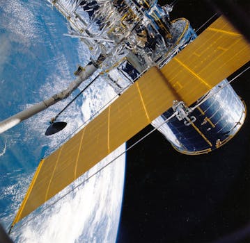
GEO Satellites: Unlocking the Power of Geostationary Orbit
GEO satellites, short for Geostationary Earth Orbit satellites, are a type of satellite that orbits the Earth at an altitude of approximately 36,000 kilometers above the equator. At this height, GEO satellites remain stationary relative to a fixed point on the Earth’s surface, allowing them to provide continuous coverage of a specific region. This unique characteristic makes GEO satellites an essential component of modern satellite communications.
The concept of GEO satellites was first introduced by scientist Arthur C. Clarke in 1945. Since then, these satellites have become increasingly important for a variety of applications, including telecommunications, weather forecasting, and navigation. In this article, we will delve into the world of GEO satellites, exploring their history, applications, and the benefits they provide.
History of GEO Satellites
The first GEO satellite, Syncom 2, was launched in 1963 by NASA. This satellite was designed to test the feasibility of geostationary orbit and paved the way for the development of modern GEO satellites. In the following years, several countries launched their own GEO satellites, including the Soviet Union, Europe, and Japan. Today, there are over 500 GEO satellites in orbit, providing a range of services to users around the world.
One of the key advantages of GEO satellites is their ability to provide continuous coverage of a specific region. This is achieved by positioning the satellite at an altitude where its orbital period matches the Earth’s rotational period, resulting in a stationary position relative to a fixed point on the Earth’s surface. This allows GEO satellites to provide a range of services, including television broadcasting, telecommunications, and weather forecasting.
Applications of GEO Satellites
GEO satellites have a wide range of applications, including telecommunications, weather forecasting, navigation, and Earth observation. In the field of telecommunications, GEO satellites are used to provide broadband internet, television broadcasting, and mobile communications. They are also used for weather forecasting, providing images of cloud patterns, sea surface temperatures, and other meteorological data.
In addition to these applications, GEO satellites are also used for navigation, providing location information and timing signals to GPS receivers on the ground. They are also used for Earth observation, providing images of the Earth’s surface and monitoring environmental changes such as deforestation, ocean pollution, and climate change.
Benefits of GEO Satellites
The benefits of GEO satellites are numerous. One of the key advantages is their ability to provide continuous coverage of a specific region, allowing for real-time communication and data transfer. They also provide a high level of reliability, with many GEO satellites operating for 15 years or more. Additionally, GEO satellites can be used to provide services to remote or underserved areas, where traditional communication infrastructure is limited or non-existent.
Another benefit of GEO satellites is their ability to provide a range of services simultaneously. For example, a single GEO satellite can provide television broadcasting, broadband internet, and mobile communications, making them a highly efficient and cost-effective solution for a range of applications.
Conclusion
In conclusion, GEO satellites play a vital role in modern satellite communications. Their ability to provide continuous coverage of a specific region, combined with their high level of reliability and versatility, make them an essential component of modern telecommunications. As the demand for satellite communications continues to grow, the importance of GEO satellites will only continue to increase, providing a range of services to users around the world.
