GEO Satellites: Unlocking the Power of Geostationary Orbit
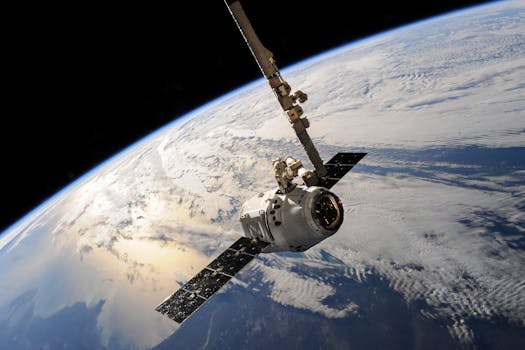
GEO satellites, or geostationary satellites, are a type of satellite that orbits the Earth at an altitude of approximately 36,000 kilometers, allowing them to remain stationary relative to a fixed point on the planet’s surface. This unique characteristic makes them ideal for a variety of applications, including telecommunications, weather forecasting, and navigation.

GEO Satellites: Unlocking the Power of Geostationary Orbit
GEO satellites, or geostationary satellites, are a type of satellite that orbits the Earth at an altitude of approximately 36,000 kilometers, allowing them to remain stationary relative to a fixed point on the planet’s surface. This unique characteristic makes them ideal for a variety of applications, including telecommunications, weather forecasting, and navigation. In this article, we will explore the world of GEO satellites, their history, technology, and applications, as well as their impact on our daily lives.
The concept of GEO satellites was first proposed by Arthur C. Clarke in 1945, and the first successful launch of a GEO satellite, Syncom 2, took place in 1963. Since then, thousands of GEO satellites have been launched, with many more scheduled for launch in the coming years. These satellites have revolutionized the way we communicate, navigate, and predict the weather, and have become an essential part of modern life.
How GEO Satellites Work
GEO satellites work by orbiting the Earth at an altitude of approximately 36,000 kilometers, which is the perfect distance to allow them to remain stationary relative to a fixed point on the planet’s surface. This is achieved by matching the satellite’s orbital period to the Earth’s rotational period, which is 24 hours. As a result, the satellite appears to be stationary in the sky, allowing it to provide continuous coverage of a specific region.
The technology used in GEO satellites has evolved significantly over the years, with advances in materials, propulsion systems, and electronics. Modern GEO satellites are equipped with high-gain antennas, transponders, and other equipment that enable them to transmit and receive data, voice, and video signals. They also have sophisticated navigation systems, including GPS and star trackers, which allow them to maintain their position and orientation in space.
Applications of GEO Satellites
GEO satellites have a wide range of applications, including telecommunications, weather forecasting, navigation, and Earth observation. They are used by television broadcasters to transmit signals to cable headends and direct-to-home platforms, and by telecommunications companies to provide internet and phone services to remote areas. Weather forecasting agencies use GEO satellites to monitor cloud patterns, sea surface temperatures, and other meteorological phenomena, allowing them to predict weather patterns and issue warnings for severe weather events.
In addition to these applications, GEO satellites are also used for navigation, providing location information and timing signals to GPS receivers on the ground. They are also used for Earth observation, providing images and data on the planet’s surface, oceans, and atmosphere. This information is used by scientists to study climate change, monitor natural disasters, and track changes in the environment.
Impact of GEO Satellites on Our Daily Lives
GEO satellites have a significant impact on our daily lives, providing us with a wide range of services and information that we rely on. From telecommunications and navigation to weather forecasting and Earth observation, GEO satellites play a vital role in modern life. They have also enabled the development of new industries and services, such as satellite television and broadband internet, which have transformed the way we entertain ourselves and access information.
In conclusion, GEO satellites are a remarkable technology that has revolutionized the way we communicate, navigate, and predict the weather. Their unique characteristic of remaining stationary relative to a fixed point on the planet’s surface makes them ideal for a variety of applications, and their impact on our daily lives is significant. As the demand for satellite services continues to grow, the development of new GEO satellites and technologies will be essential to meet the needs of a rapidly changing world.


