GEO Satellites: Unlocking the Power of Geostationary Orbit
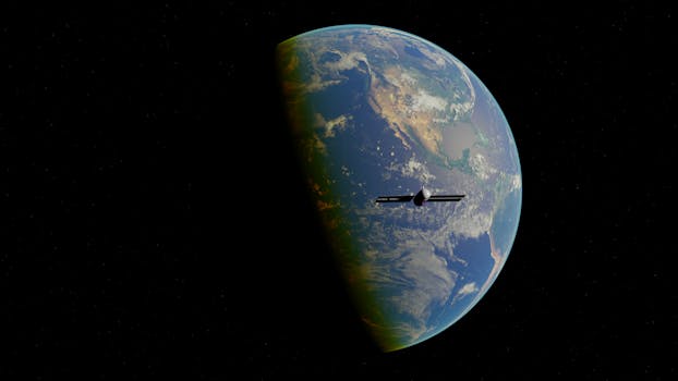
GEO satellites, or Geostationary satellites, are a type of satellite that orbits the Earth at an altitude of approximately 36,000 kilometers, remaining stationary relative to a fixed point on the planet. This unique characteristic allows GEO satellites to provide continuous coverage of a specific region, making them ideal for a range of applications, including communication, navigation, and weather forecasting. In this article, we’ll explore the world of GEO satellites, from their history and technology to their uses and benefits.
History of GEO Satellites
The concept of GEO satellites dates back to the 1940s, when science fiction writer Arthur C. Clarke proposed the idea of using geostationary satellites for communication purposes. However, it wasn’t until the 1960s that the first GEO satellite, Syncom 2, was launched. This satellite, launched by NASA in 1963, demonstrated the feasibility of geostationary orbit and paved the way for the development of modern GEO satellites. Since then, numerous GEO satellites have been launched, with applications ranging from television broadcasting to military communications.
Technology Behind GEO Satellites
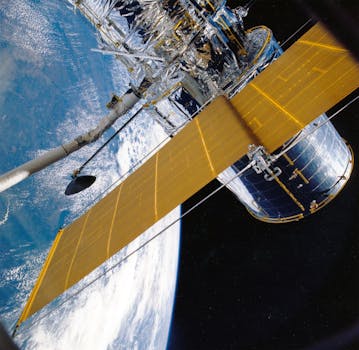
GEO satellites use a combination of advanced technologies to maintain their geostationary orbit and provide continuous coverage of a specific region. These technologies include high-gain antennas, transponders, and propulsion systems. High-gain antennas allow GEO satellites to transmit and receive signals with high accuracy, while transponders enable the satellite to amplify and re-transmit signals. Propulsion systems, such as ion thrusters, are used to maintain the satellite’s position and altitude. Additionally, GEO satellites often employ advanced materials and designs, such as solar panels and radiation shielding, to ensure their longevity and performance.
Applications of GEO Satellites
GEO satellites have a wide range of applications, including communication, navigation, weather forecasting, and Earth observation. In the field of communication, GEO satellites are used for television broadcasting, telephony, and internet connectivity. They are also used for navigation, providing location information and timing signals for GPS and other navigation systems. Weather forecasting is another critical application of GEO satellites, which use advanced sensors and imaging technology to monitor weather patterns and predict storms. Finally, GEO satellites are used for Earth observation, providing valuable data on climate change, natural resources, and environmental monitoring.
Benefits and Challenges of GEO Satellites

GEO satellites offer a range of benefits, including global coverage, high bandwidth, and reliability. They are also relatively inexpensive to launch and maintain compared to other types of satellites. However, GEO satellites also face several challenges, including congestion in geostationary orbit, interference from other satellites, and the risk of satellite collisions. Additionally, GEO satellites are vulnerable to space weather and radiation, which can damage their electronic components and affect their performance. Despite these challenges, GEO satellites remain a crucial part of modern satellite communication, and their continued development and innovation are essential for meeting the growing demand for satellite services.
See more: