GEO Satellites: Unlocking the Power of Geostationary Orbit
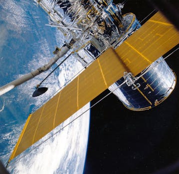
GEO satellites, or Geostationary Earth Orbit satellites, are a type of satellite that orbits the Earth at an altitude of approximately 36,000 kilometers. At this height, the satellite’s orbital period matches the Earth’s rotational period, allowing it to remain stationary in the sky. This unique characteristic makes GEO satellites an essential part of modern satellite technology, with a wide range of applications in fields such as telecommunications, weather forecasting, and navigation.
How GEO Satellites Work
GEO satellites are launched into space using a powerful rocket, which propels them to an altitude of around 36,000 kilometers. Once in orbit, the satellite uses its onboard propulsion system to maintain its position and ensure it remains stationary in the sky. This is achieved through a combination of orbital adjustments and station-keeping maneuvers, which involve firing the satellite’s thrusters to maintain its position and velocity.
The satellite’s payload, which can include transponders, antennas, and other equipment, is designed to perform a specific function, such as transmitting data or providing navigation signals. The payload is typically mounted on a platform, which provides the necessary power, communication, and control systems to support the payload’s operation.
Applications of GEO Satellites
GEO satellites have a wide range of applications, including telecommunications, weather forecasting, navigation, and Earth observation. In the field of telecommunications, GEO satellites are used to provide television broadcasting, internet connectivity, and mobile phone services. They are also used for weather forecasting, providing images of cloud patterns, storms, and other weather phenomena.
In the field of navigation, GEO satellites are used to provide positioning and timing signals, which are used by GPS receivers to determine their location and velocity. This has a wide range of applications, including aviation, maritime, and land transportation. Additionally, GEO satellites are used for Earth observation, providing images of the Earth’s surface, which can be used for a variety of purposes, including disaster response, environmental monitoring, and resource management.
Benefits of GEO Satellites
The benefits of GEO satellites are numerous and significant. They provide a wide range of services, including telecommunications, navigation, and Earth observation, which are essential for modern society. They also offer a number of advantages, including global coverage, high reliability, and low latency.
GEO satellites are also relatively inexpensive to launch and operate, compared to other types of satellites. This makes them an attractive option for a wide range of applications, from telecommunications to Earth observation. Additionally, GEO satellites can be used for a variety of purposes, including scientific research, technology development, and educational programs.