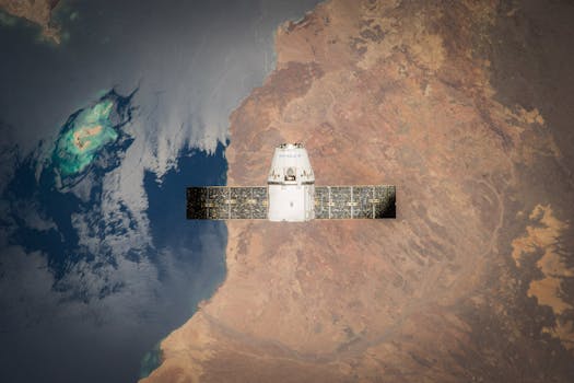
High-Tech Horizons: The Evolution of Earth-Orbiting Technologies for Observation

High-Tech Horizons: The Evolution of Earth-Orbiting Technologies for Observation
High-Tech Horizons: The Evolution of Earth-Orbiting Technologies for Observation has been a remarkable journey, marked by significant advancements in technology and innovation. The ability to observe our planet from space has revolutionized the way we understand and interact with our environment. From monitoring climate change to predicting natural disasters, earth-orbiting technologies have become an essential tool for scientists, policymakers, and industries alike.
Introduction to Earth-Orbiting Technologies
Earth-orbiting technologies refer to the use of satellites and other spacecraft to observe and study our planet from space. These technologies have been in development for several decades, with the first satellite, Sputnik, launched by the Soviet Union in 1957. Since then, there have been numerous advancements in satellite technology, including improvements in resolution, sensitivity, and data transmission.
Today, there are thousands of satellites in orbit around the Earth, providing a wide range of services, including navigation, communication, weather forecasting, and earth observation. The latter has become a critical component of earth-orbiting technologies, enabling scientists to study the Earth’s surface, atmosphere, and oceans in unprecedented detail.
Evolution of Satellite Imaging
Satellite imaging has been a key area of development in earth-orbiting technologies. The first satellite images were captured by the Corona spy satellite in the 1960s, but these were limited in resolution and scope. The launch of the Landsat satellite in 1972 marked a significant milestone in satellite imaging, providing high-resolution images of the Earth’s surface for environmental monitoring and land use planning.
Since then, there have been numerous advancements in satellite imaging, including the development of new sensor technologies, such as hyperspectral and radar imaging. These technologies have enabled scientists to study the Earth’s surface in greater detail, including the detection of subtle changes in vegetation, soil moisture, and ocean currents.
Applications of Earth-Orbiting Technologies
Earth-orbiting technologies have a wide range of applications, including environmental monitoring, climate change research, natural disaster prediction, and commercial services. For example, satellite imaging is used to monitor deforestation, track ocean currents, and predict weather patterns. Satellite data is also used to study the Earth’s climate, including the monitoring of sea level rise, glacier melting, and changes in ocean currents.
In addition to environmental monitoring, earth-orbiting technologies have numerous commercial applications, including navigation, communication, and remote sensing. For example, satellite navigation systems, such as GPS, have become essential for transportation, logistics, and emergency services. Satellite communication systems, such as satellite phones and broadband internet, provide critical connectivity for remote communities and industries.
Conclusion
In conclusion, High-Tech Horizons: The Evolution of Earth-Orbiting Technologies for Observation has been a remarkable journey, marked by significant advancements in technology and innovation. From satellite imaging to space exploration, these technologies have opened up new avenues for scientific research, environmental monitoring, and commercial applications. As we continue to develop and refine these technologies, we can expect even more exciting discoveries and innovations in the years to come.


