High-Tech Horizons: The Evolution of Earth-Orbiting Technologies for Observation
The evolution of earth-orbiting technologies has revolutionized the field of observation, enabling us to monitor and study our planet like never before. From the early days of satellite imaging to the current era of high-tech observation systems, we explore the advancements and innovations that have transformed our understanding of the Earth.
High-Tech Horizons: The Evolution of Earth-Orbiting Technologies for Observation
High-Tech Horizons: The Evolution of Earth-Orbiting Technologies for Observation has been a game-changer in the field of space exploration and observation. The ability to launch satellites and other spacecraft into orbit around the Earth has enabled us to study our planet in unprecedented detail, from the movement of the tectonic plates to the migration patterns of wildlife.
The first earth-orbiting satellite, Sputnik 1, was launched by the Soviet Union in 1957, marking the beginning of the space age. Since then, the technology has evolved rapidly, with significant advancements in areas such as satellite imaging, remote sensing, and telecommunications. The launch of the first commercial satellite, Intelsat 1, in 1965, marked the beginning of a new era in satellite communications, enabling global connectivity and paving the way for modern telecommunications systems.
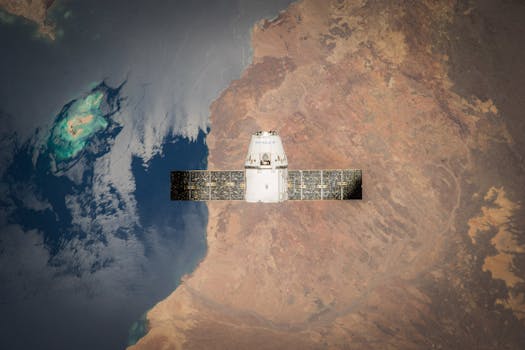
Advances in Satellite Imaging
The development of satellite imaging technologies has been a major driver of the evolution of earth-orbiting technologies. The first satellite images of the Earth were captured by the TIROS-1 satellite in 1960, which used television cameras to capture images of the Earth’s cloud cover and weather patterns. Since then, satellite imaging technologies have become increasingly sophisticated, with the development of high-resolution imaging systems, multispectral and hyperspectral imaging, and radar and lidar systems.
Today, satellite imaging is used for a wide range of applications, from monitoring weather patterns and tracking natural disasters to studying the movement of glaciers and ice sheets. The use of satellite imaging has also enabled the creation of detailed maps of the Earth’s surface, which have been used for applications such as urban planning, agriculture, and natural resource management.
Remote Sensing and Earth Observation
Remote sensing and earth observation are key applications of earth-orbiting technologies. Remote sensing involves the use of satellite or airborne sensors to collect data about the Earth’s surface, while earth observation involves the use of satellites and other spacecraft to study the Earth’s environment and climate. The development of remote sensing and earth observation technologies has enabled scientists to study the Earth’s systems in unprecedented detail, from the movement of the oceans to the behavior of the atmosphere.
The use of remote sensing and earth observation technologies has also enabled the creation of detailed models of the Earth’s systems, which are used for applications such as weather forecasting, climate modeling, and natural disaster prediction. The European Space Agency’s Copernicus program, for example, provides a wide range of earth observation data and services, including satellite imagery, atmospheric data, and oceanographic data.
Conclusion
In conclusion, High-Tech Horizons: The Evolution of Earth-Orbiting Technologies for Observation has revolutionized the field of space exploration and observation. The development of satellite imaging, remote sensing, and earth observation technologies has enabled us to study the Earth in unprecedented detail, from the movement of the tectonic plates to the migration patterns of wildlife. As the technology continues to evolve, we can expect to see even more innovative applications of earth-orbiting technologies, from monitoring climate change to predicting natural disasters.