How Satellites Monitor Climate Change and Environmental Shifts
How satellites monitor climate change and environmental shifts is a vital aspect of understanding the health of our planet. Satellites have been instrumental in monitoring the effects of climate change, providing valuable data on rising temperatures, melting ice caps, and extreme weather events. With the help of advanced satellite technologies, scientists can track changes in the environment, predict future trends, and develop strategies to mitigate the impacts of climate change.
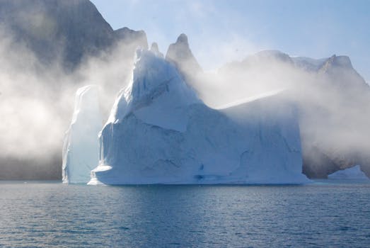
Satellites in orbit around the Earth use a variety of instruments to collect data on the environment. These instruments include cameras, spectrometers, and radar systems, which can detect changes in the Earth’s surface, atmosphere, and oceans. For example, satellites can measure the extent of sea ice cover, track the movement of glaciers, and monitor the health of coral reefs. This data is then used to study the impacts of climate change on ecosystems and human societies.
The Role of Satellites in Monitoring Climate Change
The role of satellites in monitoring climate change is multifaceted. Satellites can detect changes in the Earth’s temperature, which is a key indicator of climate change. They can also track the movement of weather patterns, such as hurricanes and droughts, which are becoming more frequent and intense due to climate change. Additionally, satellites can monitor the health of forests, which are critical for absorbing carbon dioxide and producing oxygen.
One of the most significant contributions of satellites to climate change research is the measurement of sea level rise. Satellites can detect changes in the height of the ocean surface, which is a key indicator of sea level rise. This data is critical for understanding the impacts of climate change on coastal communities and ecosystems. Satellites can also track the movement of ice sheets and glaciers, which is essential for understanding the contribution of melting ice to sea level rise.
Technologies Used for Satellite Monitoring
Several technologies are used for satellite monitoring of climate change and environmental shifts. These include optical imaging, radar imaging, and spectroscopy. Optical imaging uses cameras to capture images of the Earth’s surface, which can be used to study changes in land use, deforestation, and ocean color. Radar imaging uses radar systems to penetrate clouds and collect data on the Earth’s surface, even in areas with heavy cloud cover. Spectroscopy uses instruments to measure the reflection and emission of light by the Earth’s surface, which can be used to study the composition of the atmosphere and the health of ecosystems.
Applications of Satellite Data
The applications of satellite data for monitoring climate change and environmental shifts are numerous. Satellite data can be used to study the impacts of climate change on ecosystems, human health, and the economy. It can also be used to develop strategies for mitigating the impacts of climate change, such as reducing greenhouse gas emissions and protecting vulnerable ecosystems. Additionally, satellite data can be used to predict future trends in climate change, which is critical for developing effective adaptation and mitigation strategies.
In conclusion, satellites play a vital role in monitoring climate change and environmental shifts. With the help of advanced satellite technologies, scientists can track changes in the environment, predict future trends, and develop strategies to mitigate the impacts of climate change. As the Earth’s climate continues to change, the importance of satellite monitoring will only continue to grow, providing critical data for understanding and addressing this global challenge.


