Orbiting Innovations: Exploring the Latest in Earth-Observing Technology
Orbiting Innovations: Exploring the Latest in Earth-Observing Technology has become a crucial aspect of modern science, allowing us to monitor and understand the complex systems that govern our planet. With the help of satellite imaging and remote sensing technologies, we can now collect vast amounts of data on the Earth’s surface and atmosphere, enabling us to track changes, identify patterns, and make predictions about future events.
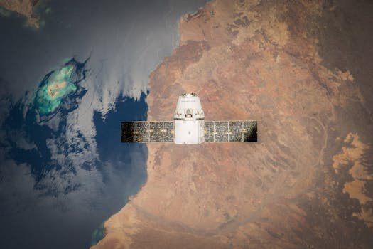
The latest advancements in Earth-observing technology have been driven by significant improvements in satellite design, sensor technology, and data processing capabilities. Modern satellites are equipped with high-resolution cameras and sensors that can detect even the slightest changes in the environment, from deforestation and land degradation to ocean currents and sea level rise.
The Power of Satellite Imaging
Satellite imaging has become an essential tool for Earth observation, providing unparalleled views of the planet and its many processes. With the ability to capture high-resolution images of the Earth’s surface, satellites can help us monitor crop health, track natural disasters, and identify areas of environmental concern. For example, the European Space Agency’s Sentinel-2 satellite has been used to monitor crop yields and detect early signs of drought, allowing farmers to take proactive measures to protect their crops.
In addition to its practical applications, satellite imaging has also played a crucial role in advancing our scientific understanding of the Earth. By providing a global perspective on the planet, satellites have helped us to identify complex patterns and relationships that were previously unknown. For instance, the NASA’s Landsat 8 satellite has been used to study the impacts of climate change on glaciers and sea ice, providing valuable insights into the dynamics of these critical systems.
Remote Sensing and Data Analysis
Remote sensing, the process of collecting data about the Earth’s surface without physical contact, has become a vital component of Earth-observing technology. By analyzing data from satellites, aircraft, and other sensors, scientists can gain a deeper understanding of the Earth’s systems and processes. For example, remote sensing has been used to study the movement of tectonic plates, the migration patterns of wildlife, and the spread of diseases.
The increasing availability of Earth-observing data has also led to the development of new data analysis techniques and tools. Machine learning algorithms, for instance, are being used to automate the processing of large datasets, allowing scientists to quickly identify patterns and trends that would be impossible to detect by manual analysis. The use of cloud computing and big data analytics has also enabled researchers to collaborate on a global scale, sharing data and insights to tackle some of the world’s most pressing environmental challenges.
Applications and Impacts
The applications of Earth-observing technology are diverse and far-reaching, ranging from environmental monitoring and natural resource management to disaster response and urban planning. By providing critical information on the state of the planet, Earth-observing technologies can help us to make informed decisions about how to manage our resources, mitigate the impacts of climate change, and ensure a sustainable future for all.
One of the most significant impacts of Earth-observing technology has been in the field of disaster response. Satellites and other remote sensing platforms can provide critical information on the extent and severity of natural disasters, allowing emergency responders to quickly assess the situation and develop effective response strategies. For example, the use of satellite imagery has been instrumental in responding to hurricanes, wildfires, and floods, saving countless lives and reducing the economic impacts of these events.
In conclusion, Orbiting Innovations: Exploring the Latest in Earth-Observing Technology has revolutionized our understanding of the planet and its many processes. With the continued advancement of satellite imaging, remote sensing, and data analysis technologies, we can expect to see even more innovative applications of Earth-observing technology in the future.