The Role of Satellites in Global Weather Forecasting Systems
Introduction to Satellites in Weather Forecasting
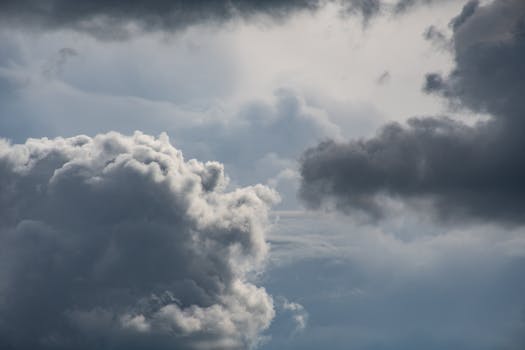
The role of satellites in global weather forecasting systems is significant, as they provide vital data and imagery to predict weather patterns and storms. Satellites in weather forecasting have revolutionized the way we monitor and predict the weather, enabling us to track weather systems and provide early warnings for severe weather events. In this article, we will explore the role of satellites in global weather forecasting systems and their impact on our daily lives.
How Satellites Contribute to Weather Forecasting
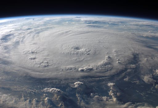
Satellites contribute to weather forecasting in several ways. They provide high-resolution images of cloud patterns, sea surface temperatures, and atmospheric conditions, which are essential for predicting weather patterns. Satellites also carry radar and lidar instruments that can penetrate clouds and provide detailed information about precipitation and other weather phenomena. Additionally, satellites can detect changes in the Earth’s magnetic field, which can indicate the approach of a storm or other severe weather event.
Satellites also play a critical role in monitoring climate change. They provide long-term data on sea level rise, ice sheet melting, and changes in ocean currents, which are essential for understanding the impacts of climate change. By analyzing satellite data, scientists can identify trends and patterns in the Earth’s climate system, which can inform policy decisions and mitigation strategies.
Types of Satellites Used in Weather Forecasting
There are several types of satellites used in weather forecasting, including geostationary satellites, polar-orbiting satellites, and low-Earth orbiting satellites. Geostationary satellites are parked in a fixed position above the equator and provide continuous imagery of the Earth’s surface. Polar-orbiting satellites orbit the Earth at a lower altitude and provide higher-resolution imagery of the polar regions. Low-Earth orbiting satellites orbit the Earth at an even lower altitude and provide detailed information about the Earth’s surface and atmosphere.
Some of the most commonly used satellites in weather forecasting include the Geostationary Operational Environmental Satellite (GOES), the Polar-orbiting Operational Environmental Satellite (POES), and the European Organisation for the Exploitation of Meteorological Satellites (EUMETSAT). These satellites provide a wide range of data and imagery, including visible and infrared images, precipitation data, and atmospheric conditions.
Conclusion
In conclusion, the role of satellites in global weather forecasting systems is vital. Satellites provide essential data and imagery to predict weather patterns and storms, and they play a critical role in monitoring climate change. By analyzing satellite data, scientists can identify trends and patterns in the Earth’s climate system, which can inform policy decisions and mitigation strategies. As technology continues to evolve, we can expect even more advanced satellites to be launched, providing even more detailed and accurate data to support weather forecasting and climate monitoring.