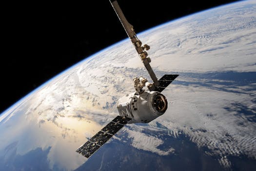
GEO Satellites: Unlocking the Power of Global Connectivity
GEO satellites, or Geostationary Earth Orbit satellites, are a type of satellite that orbits the Earth at an altitude of approximately 36,000 kilometers, remaining stationary relative to a fixed point on the equator. These satellites have been a cornerstone of modern telecommunications, providing a wide range of services including television broadcasting, telecommunications, and navigation. GEO satellites have revolutionized the way we communicate, navigate, and understand our planet.
The first GEO satellite, Syncom 2, was launched in 1963, and since then, numerous satellites have been launched into GEO orbit. These satellites have a unique characteristic – they orbit the Earth at the same rate as the planet’s rotation, which allows them to remain stationary relative to a fixed point on the equator. This makes them ideal for providing continuous coverage of a specific region, such as a country or continent.
Applications of GEO Satellites
GEO satellites have a wide range of applications, including television broadcasting, where they are used to transmit signals to receivers on the ground, allowing for global coverage of events and programs. They are also used for telecommunications, providing connectivity to remote areas where traditional communication infrastructure is limited or non-existent. Additionally, GEO satellites are used for navigation, such as in the Global Positioning System (GPS), which relies on a network of satellites in medium Earth orbit, but also uses GEO satellites as a backup.
GEO satellites are also used for remote sensing applications, such as weather forecasting, where they are used to collect data on cloud patterns, sea surface temperatures, and other environmental factors. They are also used for Earth observation, where they are used to monitor the health of our planet, tracking changes in the environment, such as deforestation, ocean health, and climate change.
Advantages and Challenges of GEO Satellites
The advantages of GEO satellites are numerous. They provide global coverage, enabling communication and navigation services to be provided to anyone, anywhere in the world. They are also cost-effective, as they can be used to provide services to a large number of users, reducing the cost per user. Additionally, GEO satellites have a long lifespan, with some satellites remaining in operation for up to 20 years or more.
However, there are also challenges associated with GEO satellites. One of the main challenges is congestion in the GEO orbit, as the number of satellites in this orbit is increasing, leading to a higher risk of collisions and interference. Another challenge is the high cost of launch, as it is expensive to launch a satellite into GEO orbit. Additionally, there are regulatory challenges, as the use of GEO satellites is regulated by international agreements and national laws, which can be complex and time-consuming to navigate.
Future of GEO Satellites
The future of GEO satellites is exciting, with new technologies and innovations being developed to improve their performance and capabilities. One of the key trends is the development of high-throughput satellites, which are designed to provide faster and more efficient communication services. Another trend is the use of electric propulsion, which allows satellites to be propelled using electricity rather than traditional chemical propulsion, reducing the cost and increasing the efficiency of satellite operations.
Additionally, there is a growing interest in the use of small satellites, which are smaller and less expensive than traditional satellites, and can be used to provide a wide range of services, including communication, navigation, and Earth observation. These small satellites are often launched into low Earth orbit, which is a lower altitude than GEO orbit, and are used to provide services such as Earth imaging and weather forecasting.


